Thailand property: read the landscape before the address
A house beside a khlong in Nonthaburi, a villa in the hills above Hua Hin, an apartment facing the Andaman Sea: in Thailand, the landscape makes the address. The national plan published on 5 October 2026 also turns it into a public works programme, with drainage and flood-protection systems for 370 urban sites by 2037, nine sponge cities and a target of 95% of eroding coastline treated. Reading water, slope, air and coast is becoming a buyer's skill: it is what separates a beautiful view from a good address.
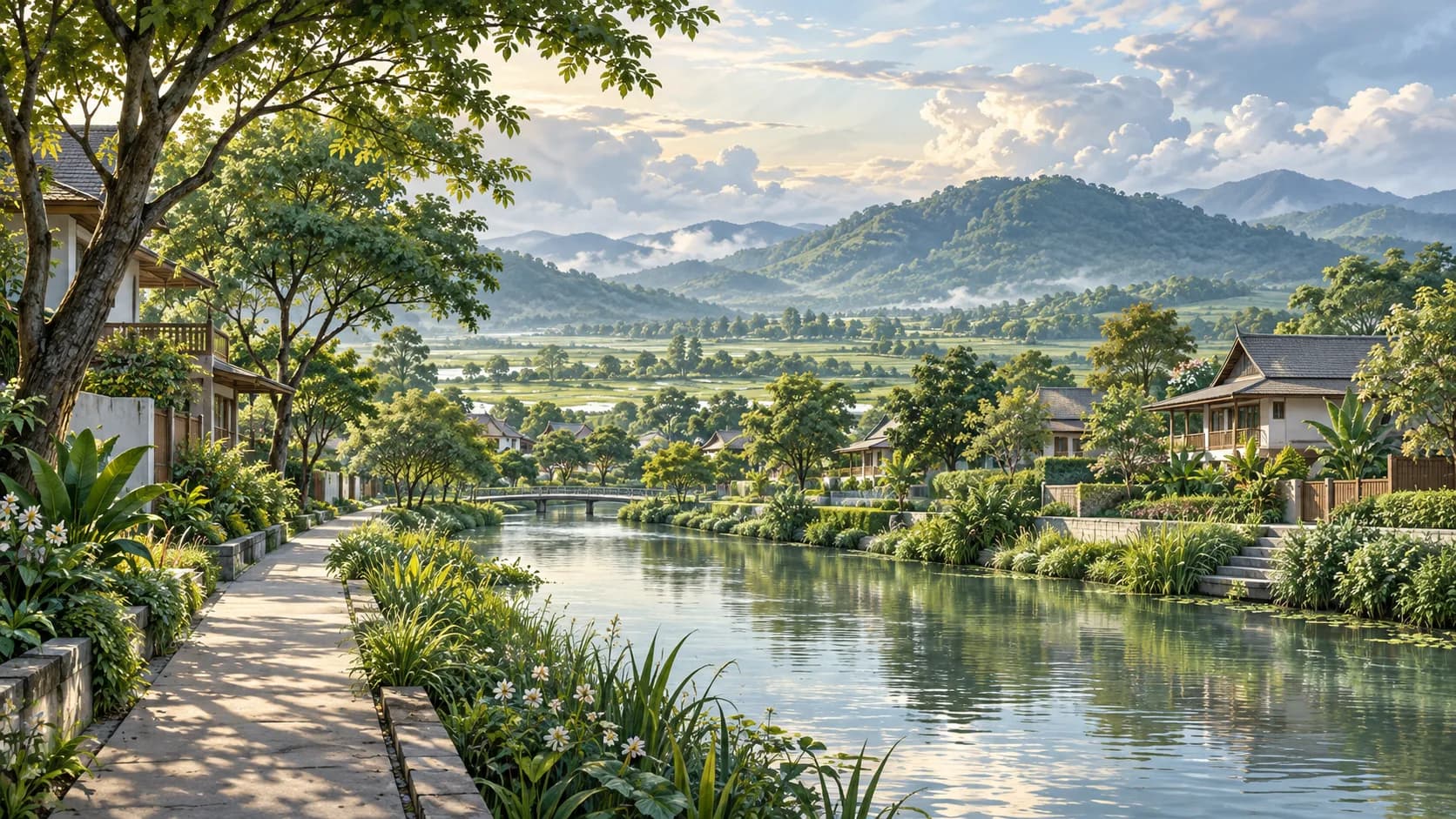
What does the landscape say about an address in Thailand?
On the Chao Phraya plain, the houses of Nonthaburi still open their terraces onto the khlong. Above Hua Hin, villas look out for the line of the Gulf; north of Chiang Mai, gardens slope down towards the rice fields. In Thailand, the landscape makes the address, and people who buy to live here know it: the quality of a place depends as much on how water drains, how the slope holds and how the air moves as on the view. The national spatial plan published in the Royal Gazette on 5 October 2026 puts numbers behind that way of looking.
Prepared by the Department of Public Works and Town and Country Planning (DPT), the text covers 2026–2037 and quantifies its effort on water: drainage and flood-protection systems for 100 urban sites in 2027, 235 in 2032 and all 370 sites identified by 2037, with 3 million rai protected by then, or 4,800 km² (printed page 80). Its method comes down to three verbs, applied from upstream to downstream: slow, store, drain (printed pages 64–65).
The idea has old roots. In the Chao Phraya basin, eleven retention plains, from Bang Rakam to Chao Chet by way of Pa Mok and Phak Hai, already serve as 'monkey cheeks' – kaem ling, the fields that hold water when the river rises (printed page 76). The plan carries this logic into towns with Water Sensitive Urban Design (WSUD): rain gardens, underground tanks, open spaces able to take water for a while. It also proposes regulating building coverage, the BCR, to leave setbacks, permeable ground and green space (printed page 65).
For anyone looking for a place to live, this grammar becomes a skill. A development that keeps natural ground, a landscaped pond instead of an asphalt car park, roads designed so that a storm runs off towards a canal: these are architects' choices that show up on a viewing and reveal how water has been thought through. The eye is the same for a Thai buyer and a foreign one, for a couple wintering on the Gulf and a family living there all year: a neighbourhood's terrain does not change with your passport. The national plan supplies the scale above – the river basin, the city and the coast.
What does the nine sponge cities policy change?
A Sponge City is organised to absorb, hold and then release rainwater. The DPT targets nine of them on printed page 83: Bangkok and eight regional centres – Nonthaburi, Chiang Mai, Phitsanulok, Khon Kaen, Nakhon Ratchasima, Pattaya, Phuket and Hat Yai. The table of measures gives them two timetables (printed page 84): Bangkok, Pattaya and Hat Yai by 2032, the other six by 2037.
In the Hat Yai–Songkhla conurbation, the plan adds a programme of its own: a drainage and storage-basin plan to prevent flooding in the city of Hat Yai (printed page 74). Elsewhere, the policy shows in the urban fabric. The plan targets 10 m² of public green space per inhabitant in 2027 and 15 m² in 2032 (printed page 199), and wants tax breaks to encourage private green spaces open to the public (printed page 207). In a neighbourhood, a park that doubles as a basin stops being scenery: it becomes infrastructure.
On the ground, the right question is not 'is this a sponge city?' but 'what is the nearest open space for?'. A sunken park, a well-kept canal, a permeable car park, the level of the street compared with the gardens: all of this can be read on a walk, and a building manager can tell you where storm water goes. A city's inclusion in the programme shows where public effort is heading; the street shows what has already been built.
Why go from the river basin down to the access road?
Water ignores municipal boundaries, hence the basin-level approach: twenty-two river basins, from the Chao Phraya to the Mekong and the rivers of the South, in which the Office of the National Water Resources is to clearly delineate flood corridors, overflow areas and low-lying land (printed pages 84–85). Land use in these areas is then to be set by town plans at every level (printed page 86), and retention areas take account of the water map published in the Royal Gazette, the ผังน้ำ (phang nam). For a plot near a river, it is a document to ask for early.
Two measures speak directly to waterside houses. Along the sixty main rivers and the canals, the plan wants banks to be surveyed against title deeds, the boundaries registered and, through planning and building law, a buffer zone created between the banks and protected water areas (printed pages 52–53). In the countryside, low-lying land that floods repeatedly is to become temporary retention areas during the flood season, with compensation measures (printed page 66). The field opposite may therefore stay open precisely because it stores water: a lasting view, as long as you know why.
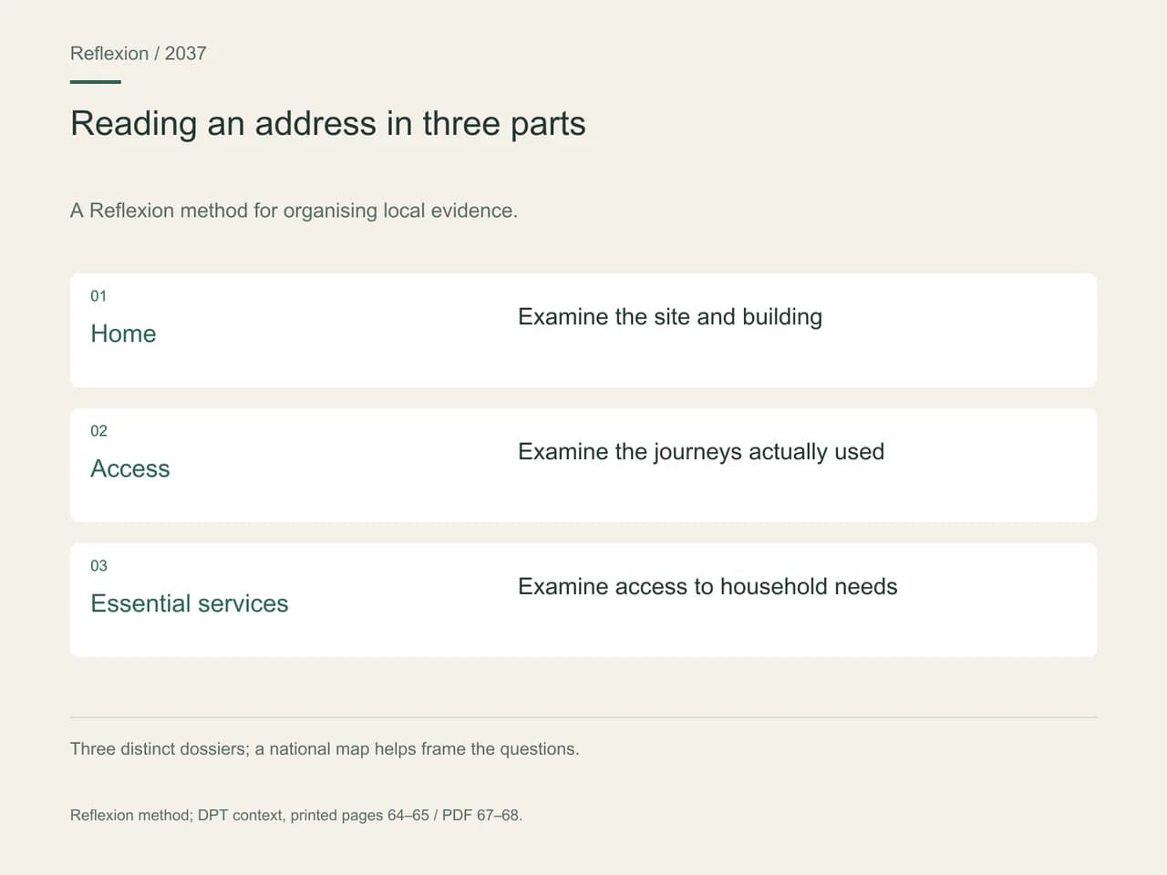
That leaves the last step down to the front door. At Reflexion, we read an address in four stages: the river basin and its flood corridors; the neighbourhood and its town plan; access, meaning the road you actually take to get home, which is not always the one in the listing; and finally the building, its drainage, its common areas and its plant rooms. Each stage has its documents and their dates. A fifth-floor apartment and the street that serves it tell different stories on a monsoon evening, and it is the street that decides whether you can get out.
For a long-term landlord, this reading becomes a service to the tenant: knowing which road stays passable, whom to call, where to park when the canal rises. A building manager who answers these questions precisely says a great deal about how well a condominium is run.
What do the plan's 370, 214 and 844 sites mean?
Three sets of urban and community sites are identified (printed page 64): 370 in flood-prone areas for a 100-year return-period flood, 214 in landslide areas for rainfall of 100 mm a day or more, and 844 in seismic-risk areas. These are parts of provinces, not whole cities, and the three lists can overlap: they do not add up. Their geography says more than their total.
Three distinct groups of urban and community sites in the plan:
| Published framework | Sites counted | Reference specified by DPT | Proposed property question |
|---|---|---|---|
| Flooding | 370 | A 100-year return period | Which documents describe the catchment, neighbourhood and access? |
| Landslides | 214 | A rainfall scenario of at least 100 mm per day | How are terrain and structures documented? |
| Earthquakes | 844 | Sites within the plan's seismic-risk areas | Which file describes the building and its characteristics? |
Region by region, the terrain takes shape. Flood-prone sites are most numerous in the North-East (109) and the North (81), followed by the South (65), the Centre (47), Bangkok and its surroundings (35) and the East (33). Landslides mainly concern the South, with 98 sites from Ranong to Satun by way of Phuket and Krabi, and the North (83), plus 21 sites in the East around Chanthaburi, Chonburi and Rayong. Seismic risk, finally, is above all northern: 540 of the 844 sites are in the North and 102 in the South, from Chumphon to Phuket. Our analysis of earthquake risk in Bangkok explains what this means for a building.
On hillsides, the plan draws a clear line: do not encourage building on slopes steeper than 35 degrees – roughly 70% in road-gradient terms – nor on repeatedly flooded low-lying land, nor in designated flood corridors (printed page 65). It also calls for risk areas to be mapped and for comprehensive town plans, the ผังเมืองรวม (phang mueang ruam), to be revised to favour low density; it is these plans, and their zoning colours, that set the rules for a plot. Higher up, another classification matters: watershed classes 1A, 1B and 2, where the plan wants to preserve headwater forests (printed page 193). What separates a good sloping plot from an average one often comes down to these three lines, checked on a topographic survey rather than a photograph.
How should you read the air and the coast through the seasons?
Air is read with a calendar. Ten areas are classified as air-quality monitoring zones – Bangkok, Samut Prakan, Samut Songkhram, Saraburi, Phitsanulok, Lampang, Tak, Chiang Mai, Chiang Rai and Phayao – where PM2.5, PM10 and ozone exceeded the standard on more than 60 days in the year according to the 2021 national pollution report (printed page 195). The same page designates 18 pollution control zones, some of them only for part of the year: Bangkok from November to March, and the provinces of Chiang Mai, Chiang Rai, Lamphun and Mae Hong Son from February to May.
For anyone splitting the year between two homes, these months matter as much as the address. A couple wintering in Chiang Mai does not live in the same city in December as in April; a family with children at school there all year will look differently at the home's ventilation and the school run. The target is for at least 90% of the targeted zones to meet the Thai standard from 2027 (printed page 198), and the plan wants tighter control of agricultural burning and forest fires (printed page 207). For today's air, it is the monitoring stations, with their date, that count: the 2021 baseline explains a list, not the sky in October 2026.
On the coast, the work is well under way. According to the plan, 753.32 km of eroding coastline had already been treated by 2021, or 91.53% of the affected length, and the target is 95% from 2027 (printed page 198). The 2022 report of the Department of Marine and Coastal Resources, cited by the plan, still counts 69.74 km untreated: 29.88 km of severe erosion, 26.79 km moderate and 13.07 km slight (printed page 202). On the Andaman side, severe erosion affects stretches of coast in Ranong, Phang Nga, Krabi, Trang and Satun, with Phuket appearing only among the moderate and slight segments; in the Gulf, the segments run from Chumphon to Narathiwat, with Phetchaburi and Prachuap Khiri Khan in the Centre, and Rayong, Chanthaburi and Trat in the East.
The planned measures sketch tomorrow's rules: land-use zoning along the coastal fringe, marine spatial planning, nature-based solutions against erosion and building setback distances (printed page 203). Some of the most sought-after shorelines already fall within environmental protection areas: Phuket province, Bang Lamung and Sattahip around Pattaya, Koh Samui, Koh Phangan and Koh Tao, Hua Hin, Pran Buri and Cha-am, and several districts of Phang Nga and Krabi (printed page 195). The plan names them without reproducing their rules: for a sea-facing project, the zone's own text is the document to ask for before you even talk about the view.
When we model two properties around Hua Hin
Take a retired couple from Manchester who want to spend six months a year in Hua Hin, then let the property year-round if they come less often. Two properties are on the shortlist: an apartment in a small development two streets from the beach, and a house in the hills west of town with a view over the Gulf. The case is modelled, with no observed transaction; it shows how the landscape changes the questions to ask.
For the apartment, they ask for the text of the environmental protection area covering Hua Hin, the setback distance applied to the building and the history of that stretch of beach, since the Prachuap Khiri Khan coast is among the eroding segments in the plan. For the house, they ask for a slope survey in degrees, details of the retaining walls and the route storm water takes, since the province has sites exposed to landslides. One rainy evening, they also drive from each property to the night market.
The apartment's file comes back complete, setback included; the house's leaves open the question of an embankment above the driveway. They choose the apartment, sign the reservation the following week and keep the hillside house in mind for a holiday rental next winter. Their choice rests on documents they have read, not on the promise of a panorama.
Modelled scenario. This profile is not a client; the parameters are working assumptions.
What you can do now
Take the address you are interested in and lay it over four layers: the river basin and the water map; the comprehensive town plan and the date of its last revision; the national plan's lists for flooding, slopes and earthquakes; and the air and the coast with their seasons. Visit when the water is high, and make the journey you will make every day. Our article on land use and where cities can grow takes this further: what may be built around you, and what will stay open.
A good map overlays these layers without merging them: the nine sponge cities with their programme status, the river basins, the three sets of sites, and the 2021 air baseline with its date. No address is labelled 'safe' or 'risky'; each one leads back to the questions and documents that concern it. That is the discipline our map guides follow.
Frequently asked questions
Does living in a sponge city protect a home from flooding?
Not on its own. Sponge-city status refers to a public stormwater-management programme (printed page 83) and attaches to no particular building. What protects a house is measured at the scale of the street and the plot: its height relative to the road, the development's drainage, its distance from a flood corridor. The programme shows where public effort will go; the plot shows what already exists.
Are the plan's 370 flood-prone sites whole cities?
No. They are urban and community areas within parts of provinces, selected for a 100-year flood (printed page 64). The same province can contain one neighbourhood that is affected and another that is not. The figure mainly serves as the basis for a target: equipping these 370 sites with drainage and protection, in stages, so that all of them are covered by 2037.
Is a 35-degree slope steep?
Yes. An angle of 35 degrees means a rise of about 70 metres for every 100 metres travelled horizontally, a road gradient of 70%. It is the threshold beyond which the national plan does not encourage building (printed page 65). A hillside can look gentle in a photograph and exceed that threshold on part of the plot; only a topographic survey expressed in degrees can settle it.
When is Chiang Mai's air most closely monitored?
From February to May. For those four months, the province is listed with Chiang Rai, Lamphun and Mae Hong Son among the plan's pollution control zones (printed page 195); for Bangkok, the period runs from November to March. Anyone weighing a year-round move against a winter stay should give this calendar as much weight as the neighbourhood. Day-to-day readings come from monitoring stations.
How do you find out whether a plot lies in a flood corridor?
From two documents. The water map, the ผังน้ำ published in the Royal Gazette, is the plan's reference for retention areas, and the Office of the National Water Resources is due to mark on it where floodwater flows, spreads and settles (printed pages 84 and 85). The local comprehensive town plan then states the permitted land use. Ask for both, dated, before making any offer.
Method and sources
Sources checked October 13, 2026
Exchange rate used: 1 EUR = 38.374 THB (28 September 2026)
- What this article draws on: the DPT's 2026–2037 national spatial plan, published in the Royal Gazette on 5 October 2026 and read in its full Thai version on 13 October 2026, for its chapters on settlements, water, natural resources and the environment. Site counts, numerical targets and lists of areas are the plan's own; the air baseline dates from 2021 and the erosion survey from 2022. The four-stage reading and the scenario belong to Reflexion's method.
- DPT, sites exposed to floods, landslides and earthquakes, slopes, comprehensive town plans and BCR, printed pages 64–66 / PDF 67–69.
- DPT, main rivers, surveying of banks and buffer zones, printed pages 52–53 / PDF 55–56.
- DPT, flood-protection targets (100, 235 and 370 sites) and nine sponge cities, printed pages 80 and 83–84 / PDF 83 and 86–87.
- DPT, retention plains, twenty-two river basins, flood corridors and the water map, printed pages 76 and 84–86 / PDF 79 and 87–89; Hat Yai–Songkhla conurbation, printed page 74 / PDF 77.
- DPT, headwater watersheds, pollution control zones, environmental protection areas and air monitoring (2021 baseline), printed pages 193–195 / PDF 196–198.
- DPT, coastal, air and green-space targets, coastal erosion by region and coastal measures, printed pages 198–203 and 207 / PDF 201–206 and 210.
- Reference rate: 1 EUR = 38.374 THB; no monetary amount is used here. The plan supports a territorial reading and certifies neither a plot nor a building.
This article is general information, not legal or tax advice. The rules cited are dated: check with a qualified professional that they are still in force before acting.