Thailand land use: where can the city grow?
On the edges of Chiang Mai, Khon Kaen and Hat Yai, the city has been spreading over the rice fields for decades, often unchecked, as the national plan published on 5 October 2026 acknowledges. It now sets numerical limits: urban areas may grow from 2.39% of the country in 2021 to no more than 3.24% in 2037, while farmland stays above 43.11% and natural forest aims for 35%. Between these thresholds, a map of neighbourhoods in the making takes shape: denser centres, growth boundaries, protected land. For a buyer, it is a new way of looking at a plot on the urban fringe: what it may become, and what will remain around it.
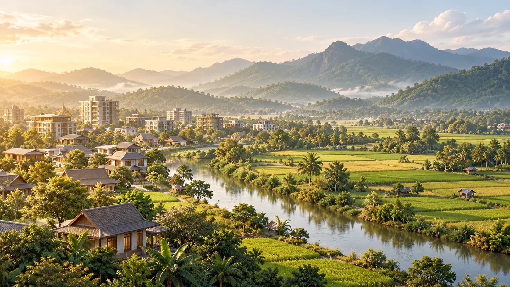
How does the plan divide up Thailand's land?
On the way out of Khon Kaen, a district road lines up, within a few kilometres, a new housing estate, a petrol station, a rice field, a warehouse and a school. You find the same fringe around Chiang Mai, Udon Thani or Hat Yai: this is where Thai cities grow. The national spatial plan published on 5 October 2026 describes this movement at national scale and sets numerical limits on it up to 2037.
The Department of Public Works and Town and Country Planning (DPT) divides the country's 515,748 km² of land (printed page 6) into three zones, following the Town Planning Charter B.E. 2566 adopted in 2023 (printed pages 13–14 and 46–47). The reserve zone, 159,272.87 km² or 30.88%, protects classified forests, national parks and wildlife sanctuaries. The conservation zone, 73,041.13 km² or 14.16%, groups productive forests, mangroves and waterways, to be used without degrading their value. The development zone, 283,434.42 km² or 54.98%, hosts housing, the economy and infrastructure networks.
Everything happens in this third zone, and it is far from built up. It combines urban areas – the territories of municipalities, Bangkok and the City of Pattaya – with prime farmland (63,057.99 km², 12.23% of the country) and general farmland (159,263.37 km², 30.88%), itself split between high-potential and low-yield land (printed pages 47–48 and 55–56). 'Development', then, does not mean buildable: the word also covers fields.
The plan presents itself as a framework. It stems from the Town Planning Act B.E. 2562 (2019), which organises plans at the scale of the country, regions, provinces, cities and rural areas, and delegates some of them to local authorities (printed page 2). Once published in the Royal Gazette, it requires government agencies to act in accordance with it (printed page 6). At the end of the chain, the rules for a plot are found in the comprehensive town plan for the city or province, the ผังเมืองรวม (phang mueang ruam), and in its zoning colours.
How does the plan bring urban growth and agriculture together?
Farmland is treated here as infrastructure. Prime land is land in which the state has invested – irrigation, flood protection, land consolidation – and land that carries products with a geographical indication; the text notes that no technology can currently replace these soils (printed page 47). Four of these products are registered in the European Union: Doi Chaang and Doi Tung coffees in Chiang Rai province, Sangyod rice from Phatthalung and Thung Kula Rong Hai jasmine rice in the North-East, covering 4,206.94 km² in total (printed page 222).
For this land, the intention is explicit: revise regulations or create measures so that it is used only for farming, and encourage farmers to keep it (printed page 56). The plan also wants agricultural zoning based on soil suitability, the Agri-Map, and confines industry to sectors located outside good or high-potential farmland and outside risk areas (printed page 58). For a house on the edge of the rice fields, this is a landscape outlook: if the field opposite is prime farmland, the plan wants it to stay a field.
The countryside, for its part, is not frozen. Outside the municipalities, across the territory of some 5,300 sub-district administrative organisations, the plan wants high-value farming with processing on site, agri-tourism routes linking organic farms and geographical-indication areas, local produce outlets, broadband internet, electric charging points and smart irrigation that allows year-round cultivation, dry season included (printed pages 228–230).
For anyone looking for a year-round home outside the cities, this suggests a lived-in, connected countryside rather than a backwater. A retiree who wants a vegetable garden and a reliable connection, a family working remotely and looking for space: what the land produces around them, and what the plan intends for it, describes their future neighbourhood better than any brochure.
Industry follows a similar logic. The plan concentrates it in the Eastern Economic Corridor, the EEC, which covers Chachoengsao, Chonburi and Rayong, and in four special economic corridors: in the North around Chiang Mai, Chiang Rai, Lamphun and Lampang; in the North-East around Nakhon Ratchasima, Khon Kaen, Udon Thani and Nong Khai; in the Central-West around Ayutthaya, Nakhon Pathom, Suphanburi and Kanchanaburi; and in the South around Chumphon, Ranong, Surat Thani and Nakhon Si Thammarat (printed pages 57–58). In the East, it plans quality housing for workers in Ban Chang and Si Racha (printed page 73): our article on Pattaya and the EEC employment area draws out the residential consequences.
The regional connections chapter extends these corridors with roads and railways towards neighbouring countries (printed page 231). On the urban fringe, all these layers overlap, and this is where a good plot parts company with a gamble. A field next to a town may look destined for housing estates; for prime farmland, the plan says the opposite and puts growth elsewhere. Buying such land for its use or its view goes with the direction of public policy; paying the price of a future housing estate for it amounts to betting against that policy.
What exactly do the land-area targets say?
The table that puts figures on this trade-off is on printed page 50. Its base year is 2021, or 2564 in the Thai calendar, its milestones are 2027, 2032 and 2037, and the direction of each threshold is part of the data: a ceiling for urban areas, floors for farmland and water, a rising target for natural forest.
National spatial-use objectives published by the DPT:
| Indicator, share of national territory | Baseline 2021 | Objective 2027 | Objective 2032 | Objective 2037 |
|---|---|---|---|---|
| Urban areas | 2.39% | At most 2.79% | At most 2.99% | At most 3.24% |
| Agricultural areas | 43.97% | At least 43.57% | At least 43.37% | At least 43.11% |
| Natural forest | 31.71% | 33% | 34% | 35% |
| Water areas | 3.02% | At least 3.02% | At least 3.02% | At least 3.02% |
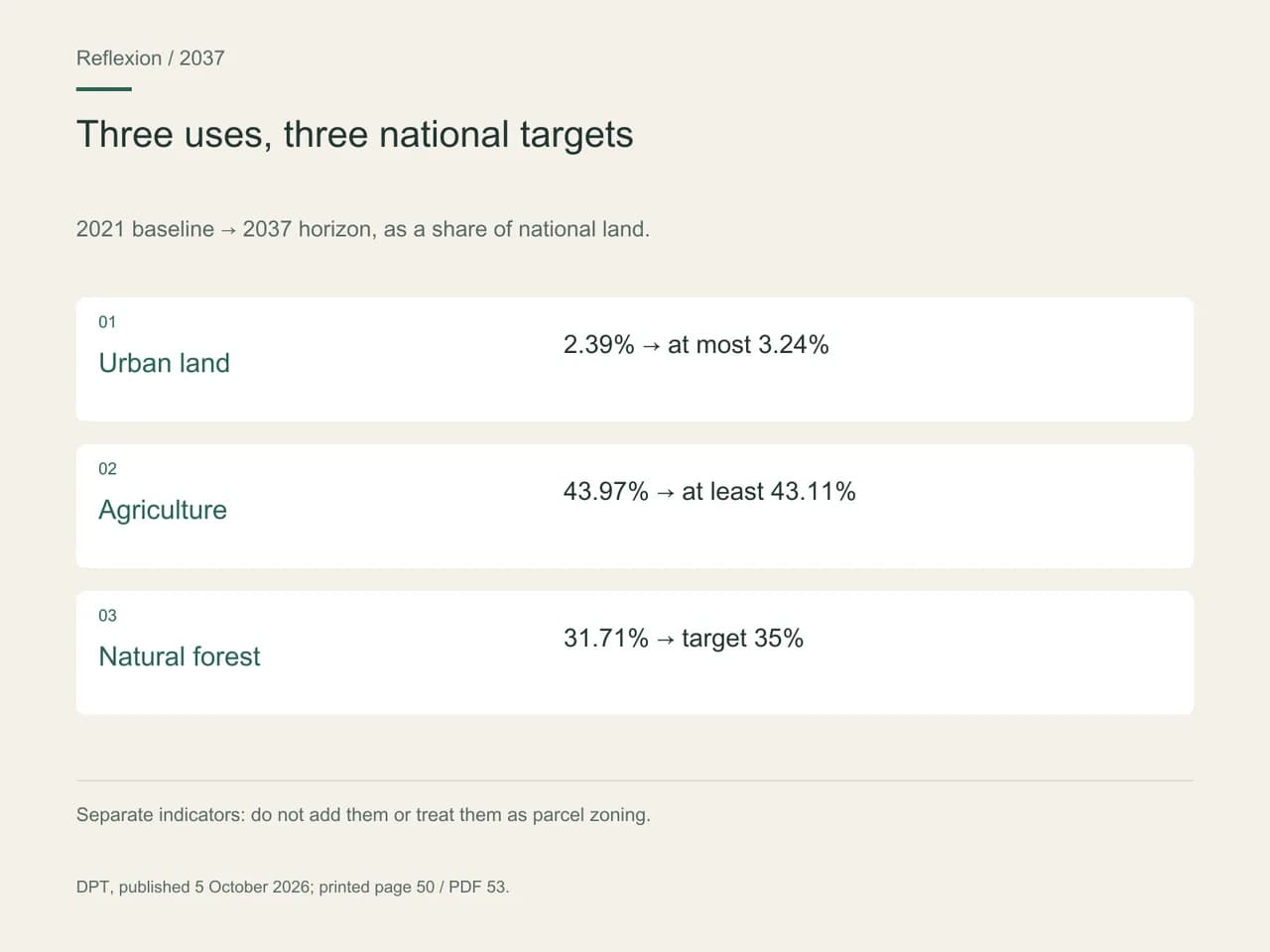
Read line by line, the table is restrained: urban areas and farmland each move by less than one percentage point of the country's land in sixteen years, natural forest by more than three. These percentages are shares of the country, not numbers of homes, and the 2.39% urban share should not be confused with the 54.98% development zone, which includes fields. The table designates no plot: a national ceiling is not a construction forecast for Hang Dong or Bang Lamung.
The direction, though, is clear, and it helps you choose. With less than one percentage point of land to gain, cities are being asked to densify and to expand within firm limits – which is exactly what the plan's urban measures describe.
How will cities grow within their limits?
Three measures, led by the Ministry of Interior, shape this growth (printed page 54). The first pushes for the adoption of an urban renewal act, with a mechanism for converting property rights to densify central and inner neighbourhoods: a bill still to be carried forward, not law in force. The second calls for a clearly drawn urban growth boundary (UGB). The third encourages owners and developers to build inside that boundary: floor-area-ratio bonuses, tax incentives, investment promotion zones, transfers of development rights, and mixed-use neighbourhoods around public transport stations – Transit-Oriented Development (TOD).
For a buyer in town, these tools play out at street level. An apartment near a future station may see the neighbouring plot benefit from a density bonus; a house just inside the growth boundary and another just outside it will not fall under the same policy. Until the boundary appears in local documents, the zoning in force is the reference, and the date of its next revision becomes a good question to ask.
The housing chapter carries the movement further (printed page 75): homes near jobs, schools and public transport to shorten journeys; public housing near transit lines for low-income households, older people and vulnerable groups; renovation of older neighbourhoods with public space, greenery and modern networks; mixed schemes combining housing, shops and green space; and urban rail transport sized to the population. The plan also provides for a study of the criteria under which rural authorities will become municipalities (printed page 70): the way a market town becomes, administratively, a city.
Old towns have their own rules. Thirty-six old towns come under the 2021 Office of the Prime Minister Regulation on the Conservation and Development of Rattanakosin and Old Towns, among them Chiang Mai, Lampang and Nan in the North, Chanthaburi in the East, and Phuket, Takua Pa, Songkhla and Trang in the South (printed pages 211 and 217). For them, the plan wants conservation town plans that protect the identity and way of life of residents, and property-tax incentives for owners who restore according to good practice (printed page 219). In Bangkok, part of Rattanakosin Island falls under a 2020 ministerial regulation that prohibits certain types of construction or alteration there (printed page 217).
A shophouse in Phuket's old town or a teak house near the walls of Chiang Mai is therefore read against two texts: the city's zoning and the conservation regulation that covers it. Around World Heritage sites such as Ayutthaya and Sukhothai, the plan wants to regulate setbacks, building envelopes, heights and the appearance of buildings (printed page 215). These rules protect what gives these neighbourhoods their value in daily use: their streets, their scale, their neighbourly life.
Which documents link the national plan to a plot?
Between the national plan and a title deed, the chain has three links. The national plan states a territory's function and the intended direction. The comprehensive town plan states the permitted use of a zone, its density and its heights. The property's own documents – title deed, boundary survey, permits – state what exists on the ground. At Reflexion, we never go from the national map to a plot without the middle link.
The most misleading word is 'development'. A plot inside the national plan's development zone may be prime rice land that the same plan wants to protect. Only the local plan, as at its date, settles the question; a seller who cites the national plan to claim that a plot is buildable is quoting the wrong document.
Physical conditions complete the picture. The plan calls for areas exposed to floods, landslides and earthquakes to be mapped, and for comprehensive town plans to be revised to favour low density there (printed page 65). A plot on the urban fringe is therefore also read through water, slope and coastline.
This reading applies to a Thai buyer as much as to a foreign one: a territory's function does not depend on nationality. Ownership structures, on the other hand, call for a separate examination specific to each situation, which this article does not cover.
When we model two houses between Chiang Mai and Lamphun
A couple – she a teacher, he working remotely – want to settle year-round in the Chiang Mai–Lamphun conurbation, which the plan treats as a single regional urban area and for which it provides public transport between the two cities (printed pages 61 and 74). They compare a townhouse in a soi near the old city walls and a house with a garden on the edge of the rice fields, on the Lamphun side. The case is modelled; it describes no transaction.
For the townhouse, they check that it lies within the old-town perimeter covered by the 2021 regulation and ask what it allows for extending the kitchen. For the house by the rice fields, they ask for the comprehensive plan's colour on the plot and on the neighbouring field, and whether that field is prime farmland. The seller presents the field as 'soon to be buildable'; the local plan classifies it as agricultural.
They choose the house by the rice fields, for its use and for the view that the neighbouring field's agricultural zoning protects as of the local plan's date, and turn down the option the seller was offering to buy that field. The townhouse stays on their list as a pied-à-terre. Their decision rests on the local plan in force, not on a promise of rezoning.
Modelled scenario. This profile is not a client; the parameters are working assumptions.
What you can do now
Place the address within the plan's three zones, then go down one level: the colour in the comprehensive town plan and the date of its last revision, and whether there is prime farmland, an old town or a future station nearby. Note what is in force and what is merely planned. Our map guides overlay these layers, each with its own source, date and scale.
Frequently asked questions
Is land in the development zone buildable?
Not necessarily. In the national plan, this zone covers 54.98% of the country's land and includes farmland that the same text wants to protect. It expresses a purpose at national level, not a right attached to a plot. Whether you can build is checked in the comprehensive town plan in force at the location, with its colour and date, and then in the documents for the land itself.
How much can Thai cities expand by 2037?
By less than one percentage point of the country's land. The urban share is capped at 3.24% of the country in 2037, against 2.39% in 2021, with steps at 2.79% in 2027 and 2.99% in 2032 (printed page 50). It is a national ceiling: it does not share growth out between cities or say which plots will take it – that is the job of local town plans.
Why look at prime farmland when buying a house?
Because it shapes the neighbourhood. According to the plan, these irrigated or flood-protected soils are to stay in farming, and measures are planned to prevent a change of use (printed page 56). A house bordering them has a good chance of keeping an open view; a plot that forms part of them is a poor bet on rezoning. The classification is confirmed in the local plan.
What does a TOD project change for a nearby development?
It can make the neighbourhood denser. The plan wants mixed-use districts around public transport stations, supported by floor-area-ratio bonuses (printed page 54). For residents, that means services closer at hand and, sometimes, taller buildings next door. Before giving the station much weight, check the line's status: under study, approved, under construction or in service.
Which old towns are covered by a conservation regulation?
Thirty-six, under the 2021 Office of the Prime Minister regulation cited in the plan (printed page 211). The North has eight, including Chiang Mai, Nan and Lampang; the South ten, including Phuket, Songkhla and Takua Pa; the East three: Chachoengsao, Rayong and Chanthaburi. For a shophouse or an old house, the exact perimeter and its requirements are checked in the text specific to each town.
Method and sources
Sources checked October 13, 2026
Exchange rate used: 1 EUR = 38.374 THB (28 September 2026)
- What this article draws on: the DPT's 2026–2037 national spatial plan, published in the Royal Gazette on 5 October 2026 and read in its full Thai version on 13 October 2026, for its legal framework (Town Planning Act B.E. 2562, printed pages 1–6) and its chapters on land use, settlements, heritage and rural development. Areas, targets and lists are the plan's own; the chain from national plan to local plan to property documents, and the scenario, belong to Reflexion's method.
- DPT, three zones, areas and Town Planning Charter B.E. 2566, printed pages 13–14 and 46–47 / PDF 16–17 and 49–50.
- DPT, make-up of the development zone, prime and general farmland, protection measures, printed pages 47–48 and 55–56 / PDF 50–51 and 58–59.
- DPT, land-area targets, 2021 base and 2027, 2032 and 2037 milestones, printed page 50 / PDF 53.
- DPT, risk mapping and revision of comprehensive town plans, printed page 65 / PDF 68.
- DPT, urban measures (renewal, growth boundary, bonuses, TOD), municipal status and housing, printed pages 54, 70 and 75 / PDF 57, 73 and 78.
- DPT, geographical indications and rural development, printed pages 222 and 228–230 / PDF 225 and 231–233.
- DPT, industry, the EEC and special economic corridors, housing in Ban Chang and Si Racha, printed pages 57–58 and 73 / PDF 60–61 and 76; Chiang Mai–Lamphun conurbation, printed pages 61 and 74.
- DPT, old towns, World Heritage and Rattanakosin, printed pages 209–219 / PDF 212–222.
- DPT, regional road and rail connections, printed page 231 / PDF 234.
- Reference rate: 1 EUR = 38.374 THB; no monetary amount is used here. The plan sets out spatial policies; it determines neither the legal status of a plot nor a building permit.
This article is general information, not legal or tax advice. The rules cited are dated: check with a qualified professional that they are still in force before acting.